Quick Navigation
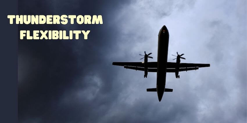
Thunderstorm flexibility is essential for all pilots. I was flying the Citation at FL370 (37000’) when I saw a thunderstorm building in the distance. I was amazed to watch and feel this energy from a far distance. The cumulonimbus clouds were building higher than the jet’s altitude. The lightning brightened the darkening sky.
Are thunderstorms really all that dangerous?
Every student pilot dreads the thunderstorm. Thunderstorms are part of summer weather in Florida, and most pilots here know to respect them. The first thing they learn is flexibility. Thunderstorms are one of nature’s most powerful forces and a weather hazard that are dangerous for all pilots. Flying too close to these powerful beasts can end in disaster. Pilots must understand thunderstorms and all weather hazards. They need to know how to avoid these dangerous conditions and safely make go-or-no-go decisions.
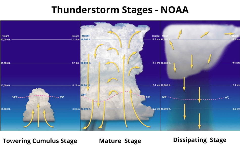
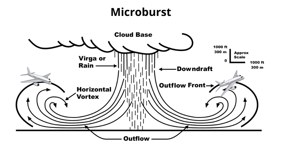
First of all, the destructive forces of thunderstorms occur within the storm itself as well as surrounding areas. Severe weather from convective systems can include many hazards. These include extremely heavy rain, strong wind shear, large hail, and severe turbulence. According to the Aeronautical Information Manual (AIM), the visible thunderstorm cloud is only a portion of a turbulent system. Updrafts and downdrafts often extend far beyond the visible storm cloud. Severe turbulence can be expected up to 20 miles from thunderstorms.
Can radar help pilots avoid thunderstorms?
Every pilot’s preflight should involve a careful review of pilot fitness using IMSAFE and weather that includes SIGMETs and Convective SIGMETs. SIGMET information includes severe turbulence, and Convective SIGMETs provide information on line, area, embedded, or severe thunderstorms. This helps with thunderstorm flexibility.
Inflight weather depiction equipment provides valuable tools for pilots, but there are limitations. One example of these limitations is that the Nexrad weather radar images update approximately every five minutes. For example, five minutes can bring dramatic changes during a fast moving, rapidly developing thunderstorm. This is another example of thunderstorm flexibility – being able to change direction or altitude at a moment’s notice.
A pilot can miss a lot between radar image updates, which can lead to bad decisions. In addition, radar images depict areas of precipitation – they cannot show turbulence. Weaving between the colored blotches on the moving map increases the potential for turbulence beyond the pilot’s and the airplane’s capabilities. This can produce disastrous results. Finally, never regard a thunderstorm as a minor threat, even when radar echoes are showing light intensity.
What if a thunderstorm impacts flight plans?
As a new pilot, my one experience avoiding a thunderstorm taught me that Get-There-Itis was not the safest or best choice. Get-There-Itis occurs when a pilot decides to continue to a planned destination even when risky conditions appear. These goal fixations can present serious flight safety issues. In other words, it is important for a pilot to understand and recognize Get-There-Itis before compromising safety.
I had checked weather before the long cross-country. Thunderstorms were predicted for long after my return. So, nearing my destination, I grew concerned when I noticed cumulus clouds building. Calling Air Traffic Control (ATC) reaffirmed my concerns. ATC offered to vector me through the storm clouds, which allowed me to land as planned.
I accepted the offer and remained clear of clouds. However, at times it was difficult to maintain control of the airplane due to the turbulence. After landing, I inspected the plane for damage and vowed to always remain a safe distance from thunderstorms. I planned to always avoid Get-There-Itis.
What is the best way to avoid thunderstorms?
Avoiding thunderstorms is the best policy. According to the FAA Advisory Circular (AC 00-24C), pilots should know all critical ways to avoid thunderstorms. These include:
- Never land or takeoff in the face of an approaching thunderstorm.
- Don’t attempt to fly under a thunderstorm.
- Do not trust the outside visual appearance as an indicator for turbulence.
- Don’t assume air traffic control will provide deviations around thunderstorms.
- Avoid relying on inflight weather radar imagery for negotiating a path through a thunderstorm area.
- Do listen to ATC frequencies for Pilot Weather Reports (PIREP), and monitor aircraft requesting deviations or diversions.
- Always ask ATC for radar navigation guidance or to approve deviations around thunderstorms.
- Definitely rely on Inflight Weather Advisory Services (AIM Chapter 7-1-6).
- Do divert and wait out the thunderstorms on the ground if you are unable to navigate safely around them.
Happy, safe pilots are flexible with their schedules, and they avoid the trap of Get-There-Itis. Most Importantly, nature’s fireworks are best enjoyed with the airplane safely secured on the ground while having a cup of coffee.
Editors may update content periodically to ensure all information remains current.
Join the Forum Discussion on Thunderstorms Below!
Disclaimer: Epic Aviation, Inc. does not verify, endorse, or approve any reviews, complaints, housing listings, or other public content. All content is provided "as is," without inspection or warranty. We do not screen users or listings and assume no responsibility for any communication, meeting, or transaction. Use is at your own risk. Use of this site constitutes acceptance of our Privacy Policy and Terms of Service.


